Out and About in Hull’s Old Town
Historian feature

Sylvia Usher explores a hidden gem in the East Riding of Yorkshire.
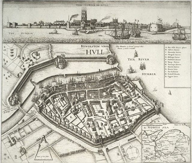
Wenceslaus Hollar’s map of seventeenth century Hull can be a street guide for the Old Town even today. Modern Hull sprawls along the Humber estuary with residential areas fanning out for three miles or more. Hull as it was until the late eighteenth century depended on the small River Hull which flowed into the estuary.
Modern tourist plans show how to explore the distinctive Old Town area. These give clearer street names than the Hollar map and are a reminder to orientate the older map, so the Humber is to the south. Together the two show that the Old Town street pattern has hardly changed, indeed, it is the medieval street plan...
This resource is FREE for Historian HA Members.
Non HA Members can get instant access for £2.49


